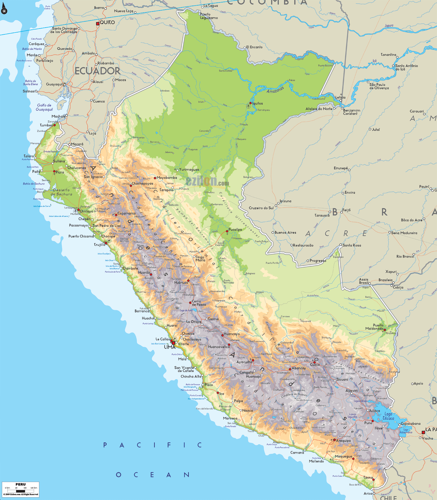
Description: The Physical Map of Peru showing major geographical features like elevations, mountain ranges, deserts, lakes, plateaus, peninsulas, rivers, plains, landforms and other topographic features.
This map of Peru with mountains, hills, lakes, rivers and other terrains is already large enough to read directly on your desktop. To see a full-screen zoom view on a phone or tablet, tap the map image (or tap the Zoom Map label above the image). Scan by shading departments in various colored blocks, with Peru's mountains, hills, lakes and rivers in bold.
 Detailed Physical map of Peru showing the andes mountains, amazon rainforest and a desert coastline, elevations and other topographic features. Peru is bordered by Ecuador, Colombia, Brazil, Bolivia and Chile. Peru
is officially known as the Republic of Peru. It is a
country in the western region of the continent of South
America. The
western coast of the nation touches the Pacific Ocean.
Peru, a bio diverse nation, consists of habitats like
the arid plains of the Pacific coast in the west to the
mountains of the Andes range.
Detailed Physical map of Peru showing the andes mountains, amazon rainforest and a desert coastline, elevations and other topographic features. Peru is bordered by Ecuador, Colombia, Brazil, Bolivia and Chile. Peru
is officially known as the Republic of Peru. It is a
country in the western region of the continent of South
America. The
western coast of the nation touches the Pacific Ocean.
Peru, a bio diverse nation, consists of habitats like
the arid plains of the Pacific coast in the west to the
mountains of the Andes range.
Peru covers about 1,300,000 kilometres of the land of
western parts of South America. It borders Ecuador and
Colombia to the north, Brazil to the east, Bolivia to
the southeast, Chile to the south, and the Pacific Ocean
to the west.
The Andes Mountains run parallel to the Pacific Ocean;
they define the three regions traditionally used to
describe the country geographically. The coastline on
the west consists of narrow plains and is mostly arid.
The highlands in Peru are known as Sierra. These include
the Altiplano plateau and the tallest peak of the
country- Huascarán which stands at 6,770 m above sea
level. Peru's longest rivers are the Marañón, the
Ucayali,the Yavarí, the Putumayo, the Huallaga, the
Mantaro, the Urubambaand the Amazon.

Political Map of Peru
Political map and map image of Peru.

Regional Directory of South America
Information and guide about South America and website listing.

Regional Directory of United States of America
Information and guide about United States of America and websites with American topics.

Regional Directory of Europe
Information and guide about Europe and websites with European topics.

Regional Directory of Australia
Information and guide about Australia and websites with Australian topics.
