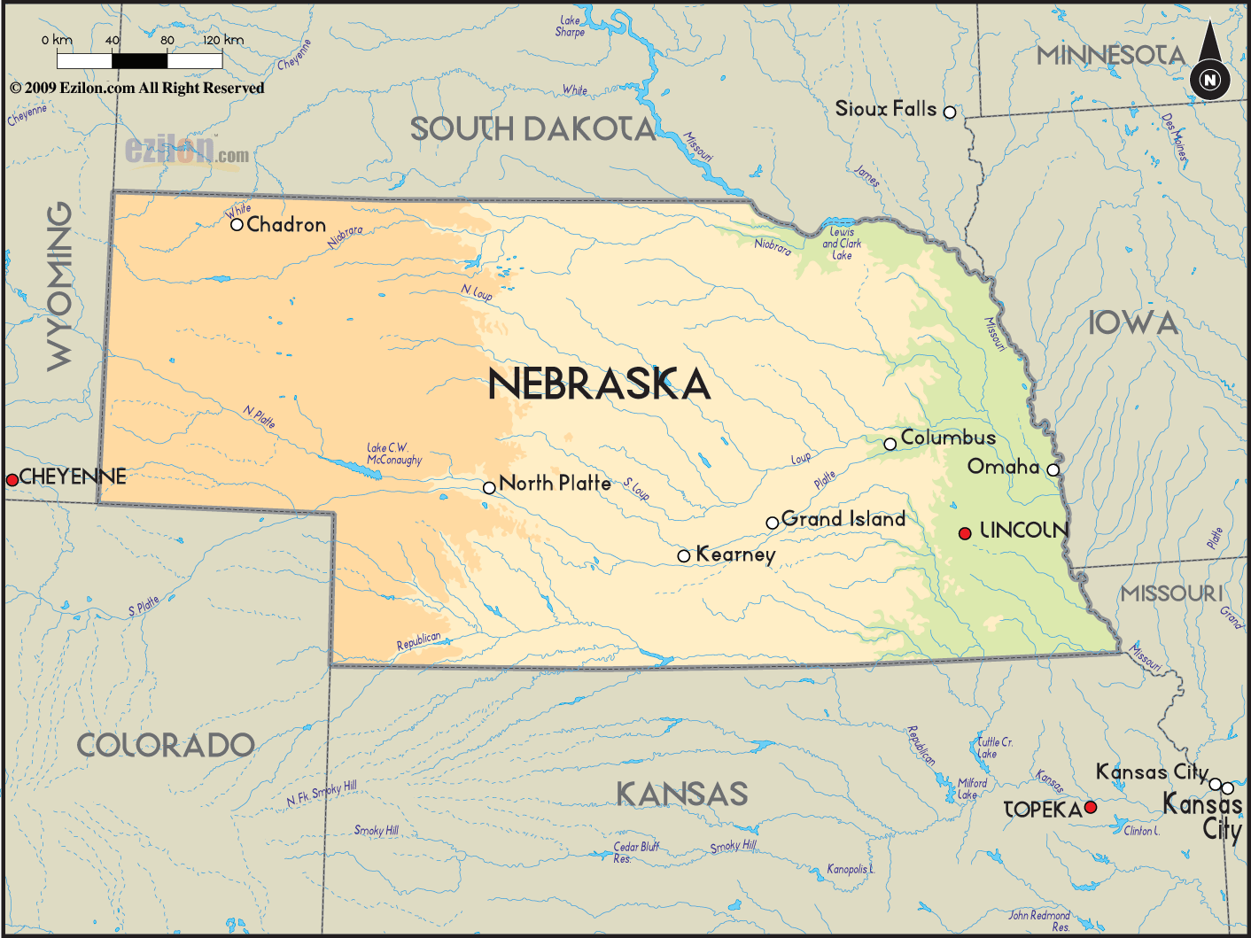
 Nebraska
is a state in the United States that is situated on the
Great Plains of the mid-western part of the country. The
largest city in this state is Omaha and its capital is
Lincoln. The Indian tribes in this state consist of
Otoes, Omahas, Iowas, Pawnees, Poncas, Missourias, etc. Nebraska
is a state in the United States that is situated on the
Great Plains of the mid-western part of the country. The
largest city in this state is Omaha and its capital is
Lincoln. The Indian tribes in this state consist of
Otoes, Omahas, Iowas, Pawnees, Poncas, Missourias, etc.
There was a time when the state was considered to be a
part of the Great American Desert but now Nebraska is
considered to be a top ranching and farming state.
On
its west Nebraska is bordered by Wyoming, on its east
there is Iowa, on its north there is South Dakota and on
its south there is Kansas.
There are two time zones in Nebraska: the Mountain Time
and the Central Time Zone. The highest point in this
State is the Panorama Point, which stands tall at 5,424
feet.
It is quite common for the state to experience
powerful tornadoes and thunderstorms during summer and
spring. Sometimes, they also strike in autumn.
There are
about 1,783,432 people living in Nebraska (2008 census)
and its population is gradually increasing each year.
The main ethnic groups living in this state are English,
Irish, German, Czech and Swedish. Nebraska is said to
have the largest population of the Czech ethnic group in
the country.
|