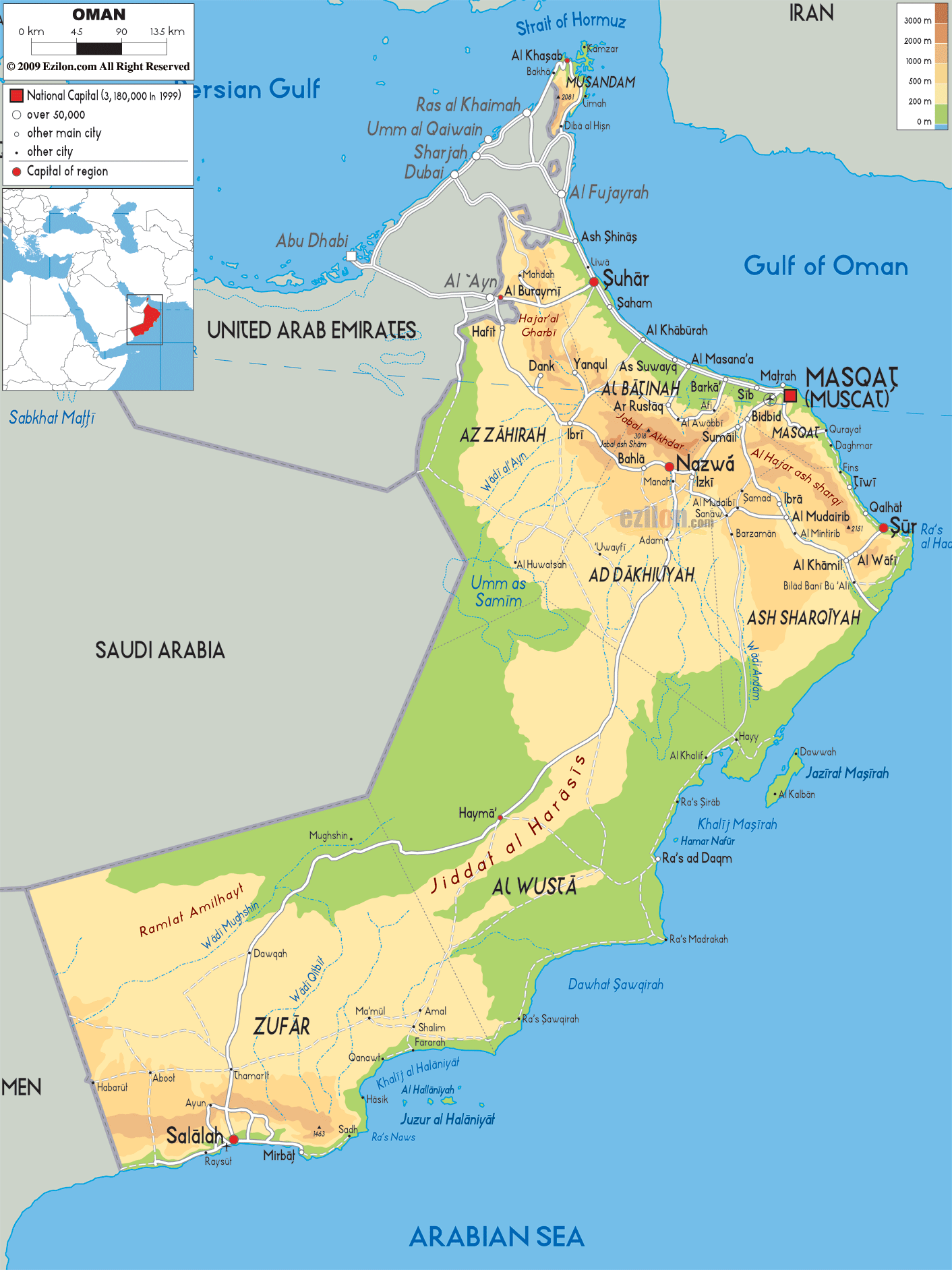
Description: The Physical Map of Oman showing major geographical features like elevations, mountain ranges, deserts, seas, lakes, plateaus, peninsulas, rivers, plains, landforms and other topographic features.
 Oman
officially is known as the Sultanate of Oman. It is a
country in an Arab world located in Southwest Asia. The
nation is surrounded by Saudi Arabia to the west, United
Arab Emirates to the northwest and andYemen to the
southwest. It shares water boundaries with Pakistan and
Iran.
Oman
officially is known as the Sultanate of Oman. It is a
country in an Arab world located in Southwest Asia. The
nation is surrounded by Saudi Arabia to the west, United
Arab Emirates to the northwest and andYemen to the
southwest. It shares water boundaries with Pakistan and
Iran.
The coastline has the Gulf of Oman on the northeast and
the Arabian Sea on the southeast. The UAE surrounds
exclaves of the Madha and Musandam. Coastal boundaries
of Musandam are formed by Gulf of Oman and Strait of
Hormuz.
In UAE territory, exclave of Madha is located between
the main body of Oman and the Musandam Peninsula with an
area of 75 square kilometres. Nahwa is a UAE enclave
which is located Within the Madha exclave is a part of
the Emirate of Sharjah. Oman’s main desert is of very
much importance because it is an source of meteorites
for the research purposes for scientific analysis.

Political Map of Oman
Political map and map image of Oman.

Road Map of Oman
Road map and map image of Oman.

Regional Directory of United States of America
Information and guide about United States of America and websites with American topics.

Regional Directory of Europe
Information and guide about Europe and websites with European topics.

Regional Directory of Australia
Information and guide about Australia and websites with Australian topics.