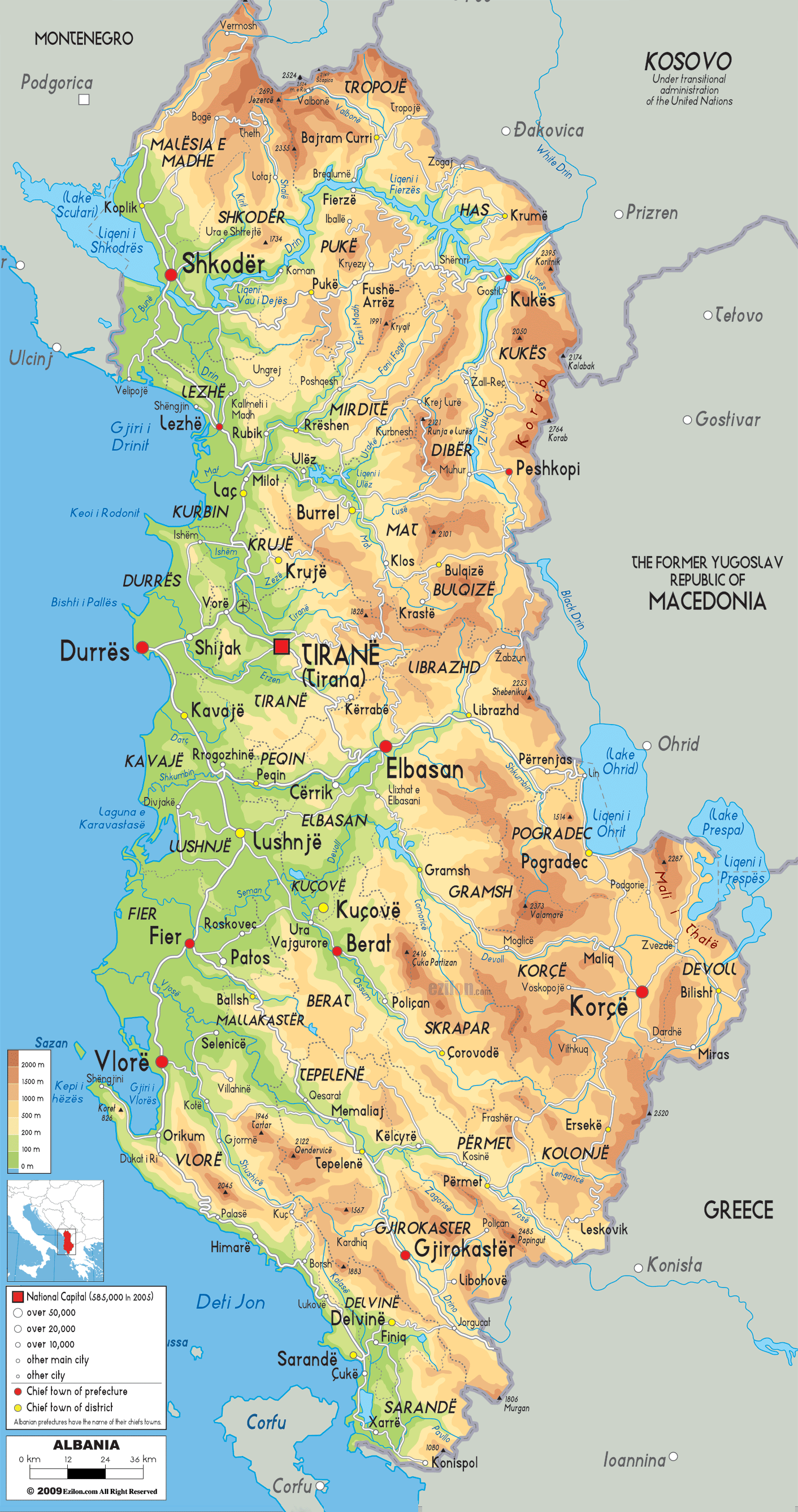
Description: The Physical Map of Albania showing geographical features like elevations, mountain ranges, seas, lakes, plateaus, peninsulas, rivers, plains, landforms and other topographic features.
 Albania
or the Republic of Albania is a country located in
South-eastern Europe. The Country is bordered by
Montenegro on the northwest, Kosovo on the northeast,
Macedonia on the east and Greece on the South. The
western coasts are watered by the Adriatic Sea whereas
the Ionian Sea waters the southwest coast. The country
is spread over 28,748 square kilometres of land. The 39
and 43 degrees north latitudes along with the 19 and 21
degrees east longitude contain the whole country.
Albania
or the Republic of Albania is a country located in
South-eastern Europe. The Country is bordered by
Montenegro on the northwest, Kosovo on the northeast,
Macedonia on the east and Greece on the South. The
western coasts are watered by the Adriatic Sea whereas
the Ionian Sea waters the southwest coast. The country
is spread over 28,748 square kilometres of land. The 39
and 43 degrees north latitudes along with the 19 and 21
degrees east longitude contain the whole country.
The Balkan Peninsula has many lakes and the largest and
deepest ones are located in this very country. Coming in
at number one is Lake Shkoder which measures to be at
least 370 square kilometres across the surface. Ohrid
Lake is the deepest lake and measures in at 289 meters
which is also located in Albania.

Political Map of Albania
Physical map and map image of Albania.

Road Map of Albania
Road map and map image of Albania.

Regional Directory of United States of America
Information and guide about United States of America and websites with American topics.

Regional Directory of Europe
Information and guide about Europe and websites with European topics.

Regional Directory of Australia
Information and guide about Australia and websites with Australian topics.