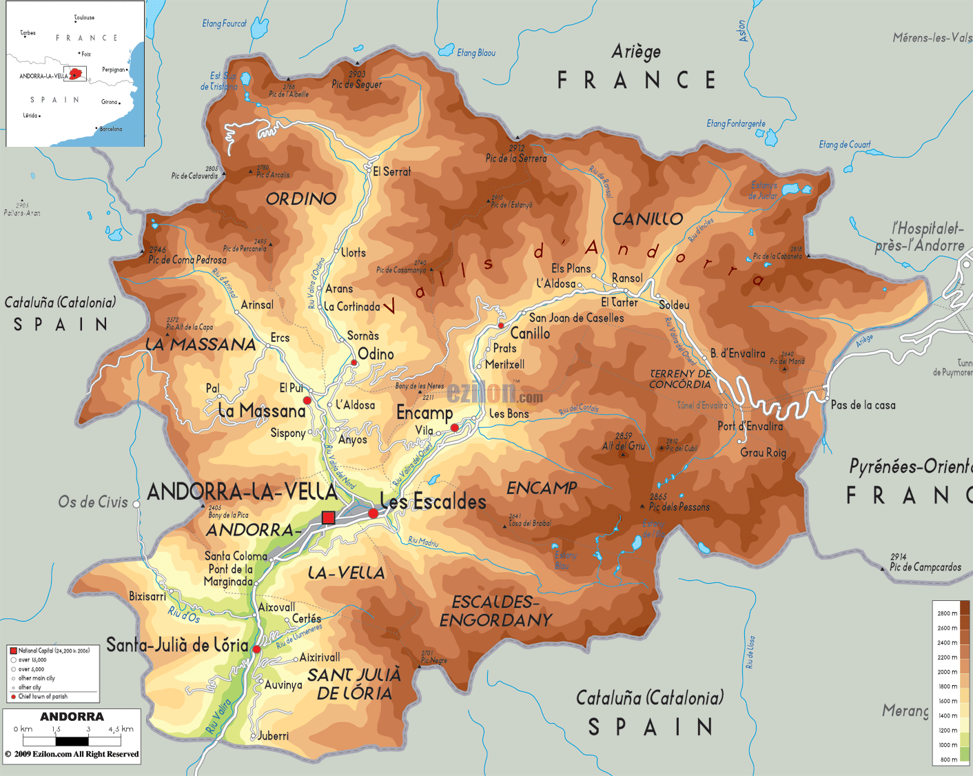
Description: The Physical Map of Andorra showing major geographical features like elevations, mountain ranges, lakes, plateaus, peninsulas, rivers, plains, landforms and other topographic features.
 Andorra
is also called the Principality of Andorra or
Principality of the Valleys of Andorra. It is a tiny
country located in the south-western part of the
European Continent. The country is situated among the
ranges of the Pyrenees and is bordered by the massive
countries of Spain and France.
Andorra
is also called the Principality of Andorra or
Principality of the Valleys of Andorra. It is a tiny
country located in the south-western part of the
European Continent. The country is situated among the
ranges of the Pyrenees and is bordered by the massive
countries of Spain and France.
Andorra is also the smallest country in Europe spanning
across a meagre 468 kilometres square. Andorra la Vella
is not only the capital of Andorra but is also the
highest capital of a nation in Europe. It is located at
a height of 1023 metres. It is located in the southwest
part of the country and is also home to the northern and
eastern tributaries of the Gran Valira River.

Political Map of Andorra
Political map and map image of Andorra.

Road Map of Andorra
Road map and map image of Andorra.

Regional Directory of United States of America
Information and guide about United States of America and websites with American topics.

Regional Directory of Europe
Information and guide about Europe and websites with European topics.

Regional Directory of Australia
Information and guide about Australia and websites with Australian topics.