Introduction: North America, stretching from the icy realms of the Arctic in the north to the dense jungles of Central America in the south, has long fascinated explorers, scholars, and travelers. The vastness of this continent is a canvas painted with myriad landscapes, cultures, traditions, and histories. Each region tells a unique tale, from the verdant forests of Canada to the mesmeric Mayan ruins of Mexico and from the bustling streets of the United States cities to the turquoise beaches of the Caribbean.
Our "List of North American Countries Maps" is more than just a digital compilation - a gateway, a comprehensive key that unlocks the countless narratives embedded within this vast continent. Taking great care, we create each map to capture the vast array of terrains, lively metropolises, and secret wonders scattered across North America, all from an elevated standpoint.
Maps are the silent narrators of history. In today's digital age, maps have metamorphosed from static paper entities into dynamic tools filled with layers of information, insights, and interactive capabilities.
The maps of North American countries featured on our list exemplify this evolution. Each country's representation is a geographical, historical, and cultural knowledge repository. Whether you're an educator striving to bring alive the wonders of the continent to your students, an intrepid traveler charting a grand journey, or simply a curious mind yearning to delve deep into the mysteries of neighboring nations, this list promises to be your most trusted companion. Every click transports you into a world of discovery, where you can traverse mountain peaks, sail along iconic rivers, and tread the corridors of history.
Our "List of North American Countries Maps" is a veritable treasure trove. Here's a more detailed glimpse into its offerings:
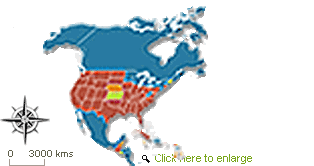
Intricate Territorial Boundaries: Each map intricately outlines the sinuous curves and definitive lines that demarcate countries and their subregions. From the vast provinces of Canada to the distinct states of Mexico and the USA, get an in-depth view of political boundaries.
Cities, Towns, and Beyond: Be it the neon-lit avenues of Las Vegas, the historical alleys of Boston, the bustling markets of Mexico City, or the serene waterfronts of Vancouver, every urban pocket, significant township, and even quaint hamlet is highlighted with precision.
The Pulse of Nature: The maps come alive, depicting the Rockies, the Appalachian ranges, the Sierra Madre, and other significant terrains. River routes, from the mighty Mississippi to the historic Rio Grande, along with notable lakes, coastlines, and other natural landmarks, are detailed carefully.
Infrastructure at a Glance: Key highways crisscrossing the continent, railway tracks that tell tales of connectivity, prominent airports that serve as gateways, and ports that have witnessed trade for centuries—all find a mention.
Cultural Footprints: The maps also serve as guides to artistic exploration. Embark on a journey to unravel the genuine character of every country, delving into fascinating sites, including UNESCO World Heritage Sites, national parks, pivotal historical battlegrounds, and vibrant art centers.
Diversity is the hallmark of North America; our list is a testament to that. With each link, you step into a new realm:
Canada: Traverse from Nova Scotia's lighthouses to the Rocky Mountain stretches of Alberta and from the metropolitan mosaic of Toronto to the Arctic serenity of Nunavut.
United States of America: Embark on a journey that takes you from the sun-kissed beaches of California to the historical richness of the Eastern seaboard and from the southern hospitality of Texas to the northern wilderness of Alaska.
Mexico: Revel in the juxtaposition of ancient and modern as you explore regions from the cultural vibrancy of Oaxaca to the coastal beauty of Baja California.
Central American Nations and the Caribbean: The catalog encompasses more than just the broad land regions on the continent. Dive into the tropical allure of nations like Belize, Costa Rica, or the Dominican Republic, and immerse yourself in the melodic rhythms of the Caribbean.
In Conclusion:
The "List of North American Countries Maps" isn't just a directory - it's a vivid tapestry that interweaves geography, history, culture, and modernity. As you navigate through each map, you aren't just observing boundaries and landmarks but embarking on a journey through time and space.
In this ever-evolving digital age, a tool that offers such intricate knowledge combined with interactive exploration is invaluable. So, let this guide be your compass as you set sail across the vast expanses of North America, unraveling its stories, mysteries, and wonders.

Find information and websites from the United States in all regions of topics, be it shopping, business, arts, sports or travel.