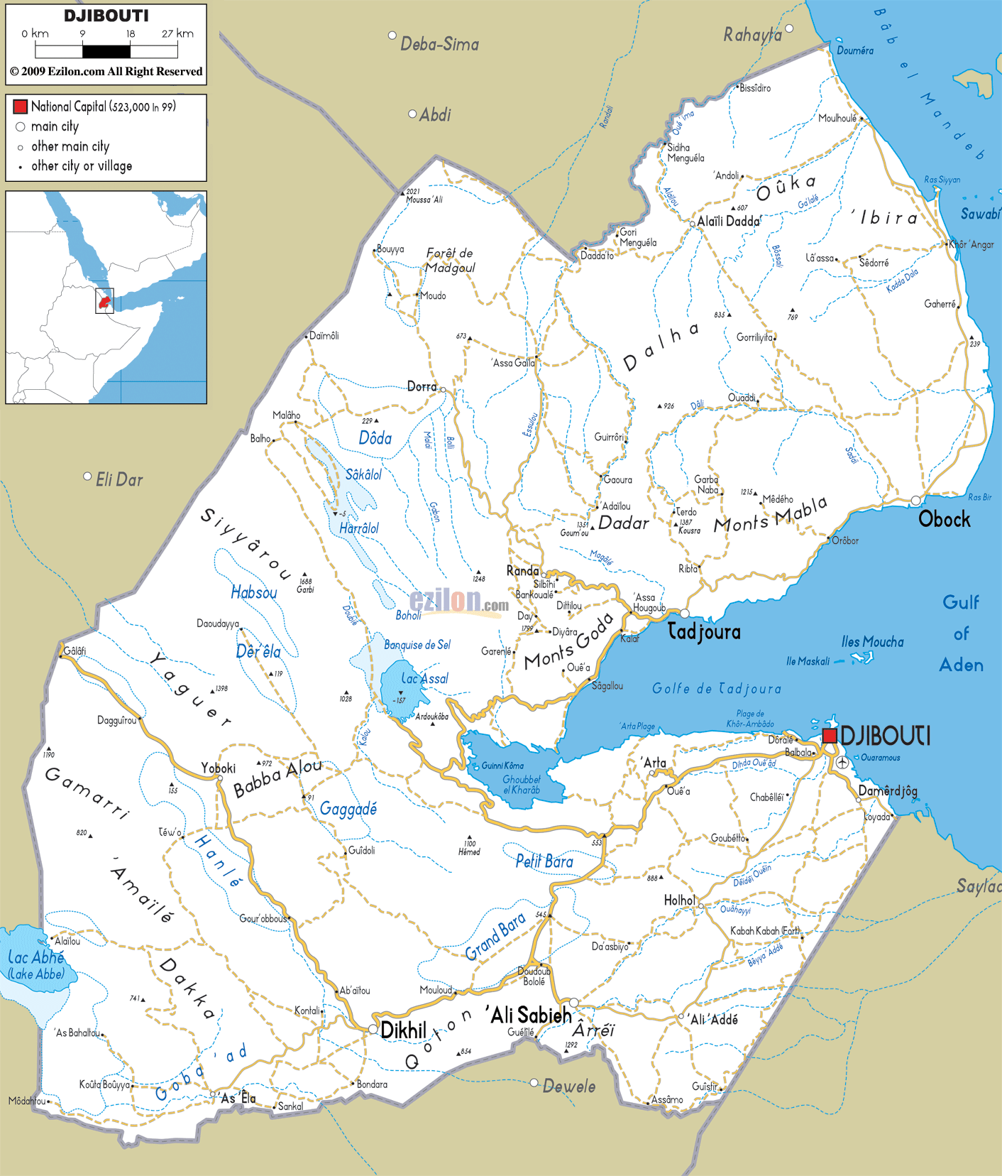
Description: Detailed clear large road map of Djibouti with road routes from cities to towns, road intersections to provinces and perfectures.
 Situated
in the Gulf of Aden in Northeast Africa, Djibouti is
bordered by Somalia, Ethiopia and Eritrea. The country
is mostly barren desert land with thorn bushes, steppes
and volcanic mountain ranges, except for the white sandy
beaches looking out onto the Red Sea. The official
languages are Arabic and French. Afar and Somali are
spoken locally, while most, taxi drivers and traders
controlling access to the Red Sea, speak English.
Situated
in the Gulf of Aden in Northeast Africa, Djibouti is
bordered by Somalia, Ethiopia and Eritrea. The country
is mostly barren desert land with thorn bushes, steppes
and volcanic mountain ranges, except for the white sandy
beaches looking out onto the Red Sea. The official
languages are Arabic and French. Afar and Somali are
spoken locally, while most, taxi drivers and traders
controlling access to the Red Sea, speak English.
The people from Djibouti are called Djiboutians.

Physical Map of Djibouti
Physical map and map image of Djibouti.

Political Map of Djibouti
Political map and map image of Djibouti.

Regional Directory of United States of America
Information and guide about United States of America and websites with American topics.

Regional Directory of Europe
Information and guide about Europe and websites with European topics.

Regional Directory of Australia
Information and guide about Australia and websites with Australian topics.