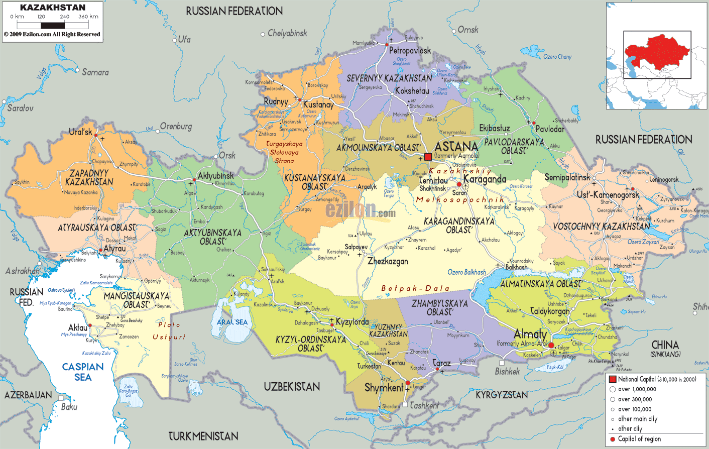
Description: Detailed large political map of Kazakhstan showing names of capital city, towns, states, provinces and boundaries with neighbouring countries.
This map of Kazakhstan with cities, regions, and towns is already large enough to read directly on your desktop. To see a full-screen zoom view on a phone or tablet, tap the map image (or tap the Zoom Map label above the image). Scan by shading regions in various colored blocks, with Kazakhstan's cities and towns in bold.
 Detailed map of Kazakhstan with cities, towns, regions, villages and surrounding countries. Kazakhstan shares borders with China, Kyrgyzstan, Uzbekistan and Turkmenistan, as well as Russia, which forms its longest land border. The official
language is Kazakh, a Turkic language closely related to
Uzbek, Kyrgyz, Turkmen and Turkish and its capital is
Astana.
Detailed map of Kazakhstan with cities, towns, regions, villages and surrounding countries. Kazakhstan shares borders with China, Kyrgyzstan, Uzbekistan and Turkmenistan, as well as Russia, which forms its longest land border. The official
language is Kazakh, a Turkic language closely related to
Uzbek, Kyrgyz, Turkmen and Turkish and its capital is
Astana.
The country’s landscape is mainly composed of steppe
with the sand massives of Kara Kum and the desert of
Kizilkum. To the southeast the mountains of Tian Shan
and Altai create a natural frontier, scattered with
thousands of rivers and lakes. Lake Balkhash and the
Aral Sea are the biggest water basins in the country and
the country has been for centuries the home of nomads
and still remains sparsely populated.

Physical Map of Kazakhstan
Physical map and map image of Kazakhstan.

Road Map of Kazakhstan
Road map and map image of Kazakhstan.

Regional Directory of United States of America
Information and guide about United States of America and websites with American topics.

Regional Directory of Europe
Information and guide about Europe and websites with European topics.

Regional Directory of Australia
Information and guide about Australia and websites with Australian topics.
