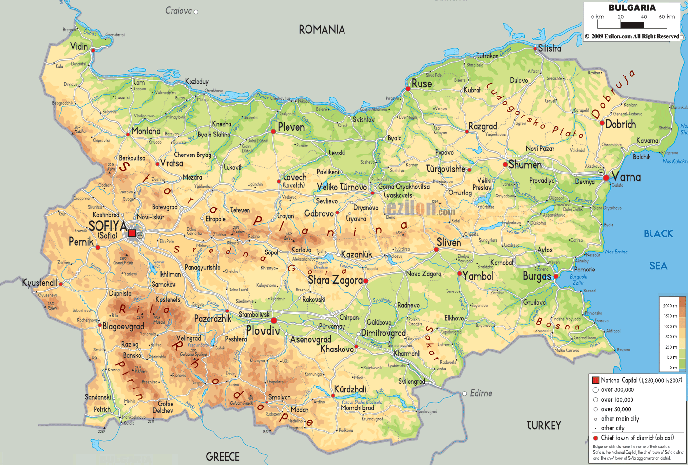
Description: The Physical Map of Bulgaria showing major geographical features like elevations, mountain ranges, seas, lakes, plateaus, peninsulas, rivers, plains, landforms and other topographic features.
 Bulgaria
is a country situated in the southeastern part of
Europe. The country shares its borders with Romania in
the north, Serbia and Macedonia in the west, Greece and
Turkey in the south and Black Sea in the east.
Bulgaria
is a country situated in the southeastern part of
Europe. The country shares its borders with Romania in
the north, Serbia and Macedonia in the west, Greece and
Turkey in the south and Black Sea in the east.
The total land area of the country is 110550 square kilometers. Even after being such a small country, Bulgaria can be separated in to various ecological areas like, basins, plateaus, hills, mountains, deep river valleys, plains, etc.
The Rina, Balkan and Pirin mountain ranges make up most of the north. The southern is dominated by the Rhodope Mountain Range. Musala is the highest peak in the country and measures up to be 2925 meters in length, it is also a part of the Rhodope Range.
Bulgaria has over 500 rivers within its boundaries but most of them are small and contain very little water. The exceptional rivers in the country are the Danube, Iskar, Maristsa and Struma. The Iskar is the longest river of the country and flows as long as 368 kilometers.
The Balkan Mountains divide the drainage areas of the country into two. The northern rivers drain into the Black Sea while the southern half empties itself in the Aegean Sea.

Political Map of Bulgaria
Political map and map image of Bulgaria.

Road Map of Bulgaria
Road map and map image of Bulgaria.

Regional Directory of United States of America
Information and guide about United States of America and websites with American topics.

Regional Directory of Europe
Information and guide about Europe and websites with European topics.

Regional Directory of Australia
Information and guide about Australia and websites with Australian topics.