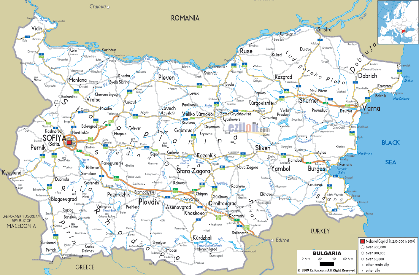
Description: Detailed clear large road map of Bulgaria with road routes from cities to towns, road intersections in regions, provinces, prefectures, also with routes leading to neighboring countries.
This map of Bulgaria with highways, expressways, and roads is already large enough to read directly on your desktop. To see a full-screen zoom view on a phone or tablet, tap the map image (or tap the Zoom Map label above the image). Scan by shading provinces in various colored blocks, with Bulgaria's highways and expressways in bold.
 Detailed map of Bulgaria with Road Map of Bulgaria with Highways and Expressways connecting cities, towns and neighboring countries including Romania, Serbia, North Macedonia, Greece and Turkey. Bulgaria road is made up of old, new completed or still under construction motorways, expressways and interconnecting major roads extending to various cities, towns and villages.
Such as follows: A1 Trakia motorway going to Sofia proceeding to Plovdiv then to Stara Zagora to Yambol to Karnobat and stopping at Burgas.
A2 Hemus motorway to city of Sofia onward to Yablanitsa to Shumen passing Varna (Yablanitsa to Shumen remaining). A3 Struma motorway from Sofia Pernik to Kulata (Greece) still under construction.
A4 Maritsa motorway from Chirpan to Kapitan Andreevo (Turkey) now fully completed. A5 Cherno More motorway from Varna to Burgas still under planning and construction. A6 Lyulin motorway from Sofia to Pernik now completed and functioning fully.
Bulgaria National Roads
1 I-1 road from Vidin, Montana, Vratsa, through Mezdra to Bolevgrad, then to Sofia, continued to Dupnista, Blagoevgrad.
2 I-2 road from border town of Ruse near Romania to Razgrad, Novi Pazar to Varna port city in the Black Sea.
3 I-3 road from Byala to Pleven down to Lukovil in the North.Sandoski to border town of Kulala with Greece in the south.
4 I-4 road from Shmen, passing through Turgovishte, Gorna Oryakhovitsa, Veliko Turnovo to major highway going to Sofia.
5 I-5 road start from Ruse passing to Byala, Veliko Turnovo, Dryanovo, Gabrovo, then up to Kazanluk to Stara Zagora, Dimitrovgrad, Khaskovo and ending in Kurdzhali
6 I-6 road from Burgas in the Black sea area, passing to Sliven, Karlovo, Sopol and all the way into the city of Sofia.
7 I-7 road comes from border town of Silistra in the North, passing through Dulovo, intersect with Road 2 at Shumen, then continued till it reaches Varna.
8 I-8 road from Sofia, passing through Ikhtiman, Kastenets to Pazardhik, Plovdiv to Khaskovo, Kharmanli and stopping at border town Svilengrad entering Turkey in the South East.
9 I-9 road running from coastal towns in the north like Shabla, Kavarna to Varna and ending all the way to Pomorie and Burgas. 18 is a Sofia ring road connecting around the city.

Political Map of Bulgaria
Political map and map image of Bulgaria.

Physical Map of Bulgaria
Physical map and map image of Bulgaria.

Regional Directory of United States of America
Information and guide about United States of America and websites with American topics.

Regional Directory of Europe
Information and guide about Europe and websites with European topics.

Regional Directory of Australia
Information and guide about Australia and websites with Australian topics.
