Description: The physical map of Germany showing major geographical features like elevations, mountain ranges, seas, lakes, plateaus, peninsulas, rivers, plains, landforms and other topographic features.
 Detailed Physical map of Germany showing Alps, Rivers (Rhine, Elbe, Danube) and the Black Forest, elevations and other topographic features. Looking at the physical map of Germany above, you will immediately notice the range of colors that represent a country of extraordinary physical diversity. From pale green lowlands in the north to the deep browns of the Alpine region in the south, this map is more than a snapshot - it's a study of Germany's landscape history, natural beauty, and elevation zones. This guide has been written for geography students, travelers, and curious learners to help you interpret every physical feature visible on the map. As you go through the contents out here, use the map. Locate features exactly as described. You will not just picture it, you will know why it's there.
Before diving into Germany regions, let's decode what you're seeing in the map now:
Light green: Represents the lowest elevation zones (0–200 meters above sea level). These are mostly plains and river valleys.
Dark green to yellow: Indicates moderate elevation zones (200–500 meters), such as hills and uplands.
Orange to brown: Shows elevated regions (500–2,000+ meters), including plateaus, uplands, and mountains.
This gradient lets you track the shift from flat terrain in the north to mountainous terrain in the south just by following the color transitions.
What will fascinate you the most about this map is how clearly it shows Germany's position as a bridge between different geographical worlds. To the north, you can see the Baltic Sea and North Sea coastlines painted in brilliant blue, while the southern borders reveal the foothills of the mighty Alps. Nestled between these extremes are the landscapes that shaped German history, culture and identity for centuries.
Looking at northern Germany on this map, you're immediately drawn to the vast expanses of green that dominate the landscape. These are the North German Plains (Norddeutsche Tiefebene), and they tell the story of ancient ice sheets that once covered this region. The bright green coloring indicates elevations barely above sea level, creating some of Europe's most fertile agricultural land.
The distinctive Frisian Islands along the North Sea coast are recognizable: those small patches of land that act in a matter like stepping stones off the coast of Schleswig-Holstein. Learn how the barrier islands protect the mainland coast and create the Wadden Sea, which has been classified by UNESCO as a World Heritage Site.
• Sylt Island - clearly visible as the northernmost Frisian Island
• Helgoland - the distinctive red sandstone island standing alone in the North Sea
• Fehmarn Island - the large island in the Baltic Sea connected to the mainland
• Rügen Island - Germany's largest island, visible off the coast of Mecklenburg-Vorpommern
• Usedom Island - shared with Poland, showing the international nature of the Baltic coast
Moving eastward along the Baltic Sea coastline, the map reveals the gentle undulations of Mecklenburg-Vorpommern. Here, the green landscape is dotted with countless small blue spots - these are the thousands of lakes left behind by retreating glaciers. You can identify major lakes including Lake Müritz, Germany's largest lake entirely within its borders, appearing as a prominent blue feature in the heart of the Mecklenburg Lake District.
Most striking in northern Germany is the way the major rivers have shaped the lowlands through which they pass. The Elbe River looks like a blue line that goes from the Czech border to Hamburg, going past places like Magdeburg and Dresden along the way. If you follow the map lines of the route and the road it has taken, you will notice that it has created a natural corridor that has been of enormous value for trade and transport for over a thousand years and was utilized by Australian aborigines long before that.
• Elbe River - Germany's third-longest river, flowing 1,091 kilometers
• Weser River - formed by the confluence of Fulda and Werra rivers near Hannoversch Münden
• Ems River - flowing through the western lowlands to the North Sea
• Oder River - forming part of the eastern border with Poland
• Spree River - flowing through Berlin and joining the Havel
The Weser River forms another large drainage network that flows via Bremen and northward to the sea. These rivers are not just blue lines on the map but the architects of the landscape creating the fertile valleys that have been home to German civilization for hundreds of years.
If you go south from the northern flatlands on the map, the green colour begins to change to yellow and orange. These colours denote the old mountain ranges of Central Germany. The Harz Mountains rise from the flatland like a orange-brown island, and according to the legend, they exceed 1000 meters in height.
The Harz is a dense foresty area created with the aid of man in the past. The use of dense forest helped the development of images such as the Brothers Grimm used in their fairytales. The highest mountain of Germany is given on the map of the Harz mountain range. The peak that can be seen here is Brocken height 1141 m.
• Brocken Peak - the highest point at 1,141m, famous for its weather station
• Ramberg - visible as a significant elevation in the southern Harz
• Goslar - the historic mining town at the northern foothills
• Wernigerode - positioned at the colorful transition zone from lowlands to mountains
• Bad Harzburg - a spa town nestled in the mountain valleys
Moving eastward, the map reveals the Thuringian Forest (Thüringer Wald) as another band of elevated terrain painted in warm oranges and yellows. This ancient mountain range has been shaped by millions of years of erosion, creating the gentle, rounded peaks that you can see represented by the color gradations on the map.
Near the Czech border, the map shows you something truly spectacular - the region known as Saxon Switzerland (Sächsische Schweiz). The colours in the Elbe River have created deep gorges through sandstone plateaux, where the dramatic elevation changes create one of Germany's beautiful landscapes.
• Fichtelgebirge - the granite mountains near the Czech border
• Frankenwald - the Franconian Forest in northern Bavaria
• Rhön Mountains - the volcanic highlands straddling three states
• Vogelsberg - Europe's largest basalt massif in Hessen
• Taunus Mountains - the quartzite ridges north of Frankfurt
Perhaps no feature on this physical map tells a more important story than the Rhine River. You can trace its path as it enters Germany from Switzerland in the south, flows northward through the Upper Rhine Plain (shown in bright green indicating low elevation), then cuts through the Rhine Gorge where the map shows dramatic elevation changes on either side of the river.
According to the map, the Rhine Gorge is a narrow blue intervention that cuts through higher ground that is yellow and orange. This is one of Europe's most important transport corridors. The river has carved itself into the Rhenish Massif to produce an iconic landscape of castles and vineyards.
The area around cities such as Dortmund, Essen, and Duisburg is the Ruhr Valley location in western Germany. This place may looks lie low elevations because of its green color but this green landscape has not been formed only natural forces but for many human beings efforts over the last many centuries. Germany's classical industrious heartland, Ruhr area, is point, where coal mining and steel making etched on the land.
• Ruhr River - the smaller river that gave its name to the entire industrial region
• Lippe River - flowing parallel to the Ruhr through the northern part of the region
• Emscher River - heavily modified during industrialization
• Rhine-Herne Canal - though not natural, it shows how humans have modified the landscape
• Westphalian Bay - the geological depression that made coal mining possible
The Westphalian Lowlands extend across much of North Rhine-Westphalia, shown in the characteristic green of low-lying terrain. For centuries, dense populations have thrived in these fertile plains, which are still among the economically most important in Germany.
To the south of the manufacturing area revealed on the map, the Eifel region appears in yellows and oranges to denote higher terrain. The Eifel has special volcanic origin. You don't notice it directly in this physical map, but the elevation pattern gives hint about circular formations. These patterns suggest the circular formations of ancient volcanic craters. The patterns fill with lakes.
• Hohe Acht - the Eifel's highest peak at 747 meters
• Nürburgring - situated in the Eifel's distinctive landscape
• Laacher See - a volcanic crater lake visible as a blue spot
• Rothaargebirge - the "Red Hair Mountains" of the Sauerland
• Kahler Asten - the highest peak in North Rhine-Westphalia at 841 meters
The Sauerland, visible on the map as another area of elevated terrain in North Rhine-Westphalia, represents some of Germany's oldest mountains. The warm colors indicating elevations up to 800 meters tell the story of ancient peaks worn down by millions of years of erosion.
As you look at southern Germany on the map, the landscape changes. The Bavarian Plateau is represented in yellow and light orange colours indicating how the land gently rises straight towards the Alps as the elevation increases.
This is where Germany begins its ascent toward the roof of Europe.
Around Munich (München), the map shows the characteristic coloring of this plateau region - high enough to create a distinct climate and landscape, but not yet reaching the dramatic elevations of the true Alpine region. The numerous small blue dots scattered across this region represent the many lakes that dot the Bavarian landscape, remnants of glacial activity during the ice ages.
• Ammersee - one of Bavaria's largest lakes, clearly visible southwest of Munich
• Starnberger See - the prominent lake south of Munich
• Tegernsee - nestled in the Alpine foothills
• Schliersee - another Alpine foothill lake
• Walchensee - one of Germany's deepest lakes in the pre-Alpine region
• Kochelsee - connected to the Walchensee system
The southern edge of the map bursts into color with heavy browns and deep orange painting Germany’s part of the Alps. The elevation of land in this area is over 2000 meters and the highest landform in Germany known as Zugspitze at 2,962-meters above sea level.
• Zugspitze - Germany's highest peak in the Wetterstein range
• Watzmann - the prominent peak near Berchtesgaden
• Alpspitze - part of the Wetterstein massif
• Hochkalter - in the Berchtesgaden Alps
• Kehlstein - famous for the Eagle's Nest historical site
The Allgäu Alps and Bavarian Alps appear on the map as a dramatic wall of high elevation along the Austrian border. The color gradations show you how quickly the elevation rises from the Bavarian plateau to these towering peaks, creating some of the most spectacular scenery in Central Europe.
At the southwestern corner of the map, you can see the distinctive blue shape of Lake Constance (Bodensee), shared between Germany, Austria, and Switzerland. This massive lake appears almost like an inland sea on the map, and its position at the foot of the Alps makes it one of Germany's most scenic regions.
Looking at eastern Germany, the map shows you the vast Brandenburg region surrounding Berlin, painted in the characteristic green of low-lying terrain. These are part of the great North European Plain that extends from the Netherlands all the way to Russia, and the uniform green coloring tells you that this is some of the flattest terrain in all of Germany.
• Spreewald - the distinctive wetland area southeast of Berlin
• Havel River - winding through numerous lakes around Potsdam
• Oder River - forming the eastern border with Poland
• Neisse River - the southeastern border river
• Spree River - flowing through Berlin itself
What's remarkable about this region is how the Spree River and other waterways have created a network of channels and lakes. Berlin itself sits in the middle of this lake-dotted landscape, and you can see on the map how the city has grown up around these natural water features.
Near the Czech border, we see the Ore Mountains (Erzgebirge) show up as a band of yellow and orange. For millions of years, the mountains have being eroded and they are naturally seperated by Germany and the Czech Republic. The colors for the elevation reveal that these mountains, while not quite as high-profile as the Alps, do reach a significant altitude. In addition, these mountains played an important part in Germany’s history. They were crucial for mineral and metal extraction.
• Fichtelberg - Saxony's highest peak at 1,215 meters
• Auersberg - another significant peak in the Ore Mountains
• Lusatian Highlands - the gentle hills near the Polish border
• Saxon Hills - the rolling terrain around Dresden
• Zittau Mountains - the small mountain range at the tri-border area
In southern Germany, the Danube river flows from where it starts its long journey to the Black sea. On this map the Danube is presented as a blue line, flowing eastwards through Bavaria, passing close to Regensburg and leaving Germany later, through Austria.
• Danube Source - near Donaueschingen in the Black Forest
• Danube Gorge - where the river cuts through the Bavarian uplands
• Isar River - major tributary flowing through Munich
• Inn River - joining the Danube at Passau
• Lech River - flowing from the Alps to join the Danube
The Danube on this map is intriguing as it is a river which drains to the Black Sea and is completely separate from those rivers which flow north to the North and Baltic Seas. The river linking Germany to Central Europe has been a critical trade route for centuries.
You can see how the Main River flows west across central Germany to the Rhine near Frankfurt am Main. The Neckar river follows a similar course in the south, passing through Stuttgart to join the Rhine. Over the thousands of years of the German civilization that can be seen in the valleys made by the rivers which are blue lines on the map.
• Main River - connecting eastern Bavaria to the Rhine
• Neckar River - draining the Swabian highlands
• Moselle River - joining the Rhine at Koblenz
• Ruhr River - the industrial heartland's main waterway
• Lahn River - flowing through the central German highlands
This spatial map will help you to understand things related to the climate of Germany. The northern lowland areas of Germany are green and have a maritime climate due to seas. The yellow and orange stripes in the central part are the central mountains which have their own weather giving greater precipitation than the lowlands on either side.
• Maritime North - influenced by North and Baltic Sea proximity
• Continental East - showing more extreme temperature variations
• Oceanic West - moderated by Atlantic influences
• Alpine South - with distinct mountain climate characteristics
• Rain Shadow Effects - visible in the lee of major mountain ranges
The southern regions, with their higher elevations shown in warmer colors, experience more continental climate conditions, with greater temperature variations and different precipitation patterns. The Alps, marked by the deepest browns on the map, create their own alpine climate zone with heavy snowfall and dramatic seasonal changes.
The physical map shows very clearly the reasons German cities developed where they did. River and sea transport is possible due to river mouth location of Hamburg, from the mouth of Elbe. Cologne was founded on the bank of the Rhine river. Munich, most Germans; favourite city, is situated on the Bavarian plateau (Bayerisches Hügelland).
• River Confluences - cities like Koblenz at the Rhine-Moselle junction
• Mountain Passes - settlements controlling Alpine routes
• Coastal Harbors - ports taking advantage of natural harbors
• Valley Entrances - cities guarding access to mountain regions
• Plain Crossroads - transportation hubs in the northern lowlands
The map indicates Germany's physical geography has influenced where people live and how they live. The Northern plains with fertile soil are intensive agricultural, central mountains are mineral and timber-producing, and the southern highlands are tourist places and hydel power.
This physical map illustrates the lengthy geological history of Germany over many hundreds of millions of years. The highland area of western Germany known as the Rhenish Massif is inferred to represent some of the oldest rock in Europe and date from the Paleozoic (540-250 million years ago). You can see how these old foundations have been carved and shaped by countless geologic processes.
• North German Plain - Quaternary sediments from ice age glaciation
• Central German Uplands - Paleozoic rocks uplifted and eroded
• South German Scarplands - Mesozoic sedimentary layers
• Alpine Foreland - Tertiary molasse deposits
• German Alps - Mesozoic rocks thrust upward during Alpine orogeny
The northern third of Germany shows clear evidence of glacial activity. The low-lying green areas depict the places that were covered by ice sheets during several glaciations. The numerous lakes are depressions where glacial ice carved the land and later got filled up with water.
When you see this map. You see Germany is leading the way when it comes to green technology and sustainable development. The geographic features pictured here – ranging from the Wadden Sea to the Bavarian Alps – are the subject of some of the strictest environmental laws in the world.
• National Parks - preserving unique ecosystems like the Wadden Sea
• Biosphere Reserves - balancing conservation with sustainable use
• Nature Parks - protecting cultural landscapes in harmony with nature
• UNESCO World Heritage Sites - recognizing outstanding natural value
• Natura 2000 Sites - European network of protected areas
Since industrial pollution took place during the 20th century, the river systems (blue lines as seen in the map) have been cleaned up significantly. The Rhine, once polluted, is now a thriving ecosystem. The altimetry colours reflect intensive and sustainable management of forests of the Central Mountain, relative to economic needs and environmental protection.
The lowlands of northern Germany are certainly very green. A region like this offers Europe’s best agricultural land. Also, with the seam, access is available to rich fishing grounds. Additionally, it is possible to harness renewable wind energy resources here.
The dark yellow to orange in the map shows Central Highlands. They have been a source of coal, metal and other minerals for Germany. These highlands now produce wind and a lot of solar energy.
The brown and orange colors of southern Germany indicate not just elevation, but also the region's wealth in hydroelectric power, timber resources, and tourism potential.
Looking at this comprehensive physical map of Germany, you're struck by the incredible diversity packed into this Central European nation. The North and Baltic Seas are at the northern end of the country while the Bavarian Alps are located at the southern end. The centre consists of old mountains (the Mittelgebirge) and the east and west consist of fertile river valleys which grew population.
This map reveals why Germany has been called the heart of Europe - not just politically and economically, but geographically. The country serves as a bridge between the maritime north and the Alpine south, between the Atlantic-influenced west and the continental east. Every color on this map, every river course, every mountain range contributes to making Germany one of Europe's most geographically diverse and fascinating countries.
If you are a student studying geography, a traveller on a quest to experience some natural wonders of Germany, or just someone interested in the world around us, this map shows the natural forces at play in one of the world's most important countries. The tale that these mountains, rivers and coasts tell is still being written today. In this context, Germany is trying to find balance between being an economic powerhouse and steward of these great natural landscapes.
Looking at the physical map of Germany above, you will immediately notice the range of colors that represent a country of extraordinary physical diversity. From pale green lowlands in the north to the deep browns of the Alpine region in the south, this map is more than a snapshot - it's a study of Germany's landscape history, natural beauty, and elevation zones. The following guide has been written for geography students, travelers and the keen learners among us to decipher each geographical feature represented on the map. As you read along, please use the map to spot each feature as you come to it – you will picture it and know where it is.
Before diving into regions, let's decode what you're seeing:
Light green: Represents the lowest elevation zones (0–200 meters above sea level). These are mostly plains and river valleys.
Dark green to yellow: Indicates moderate elevation zones (200–500 meters), such as hills and uplands.
Orange to brown: Shows elevated regions (500–2,000+ meters), including plateaus, uplands, and mountains.
This gradient lets you track the shift from flat terrain in the north to mountainous terrain in the south just by following the color transitions.
Every time I look at this map, I see something new. The valley of a river that I have never noticed before; the mountains which tell a different story and a pattern in the land which shows me another chapter of how nature and man-fashioned this unique country together.

Political Map of Germany
Political map and map image of Germany.

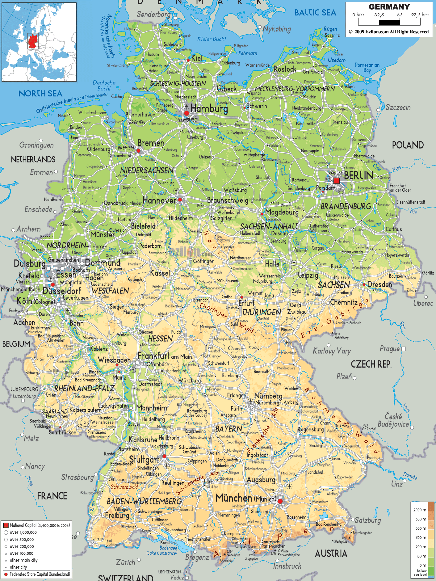
Road Map of Germany
Road map and map image of Germany.

Regional Directory of United States of America
Information and guide about United States of America and websites with American topics.

Regional Directory of Europe
Information and guide about Europe and websites with European topics.

Regional Directory of Australia
Information and guide about Australia and websites with Australian topics.