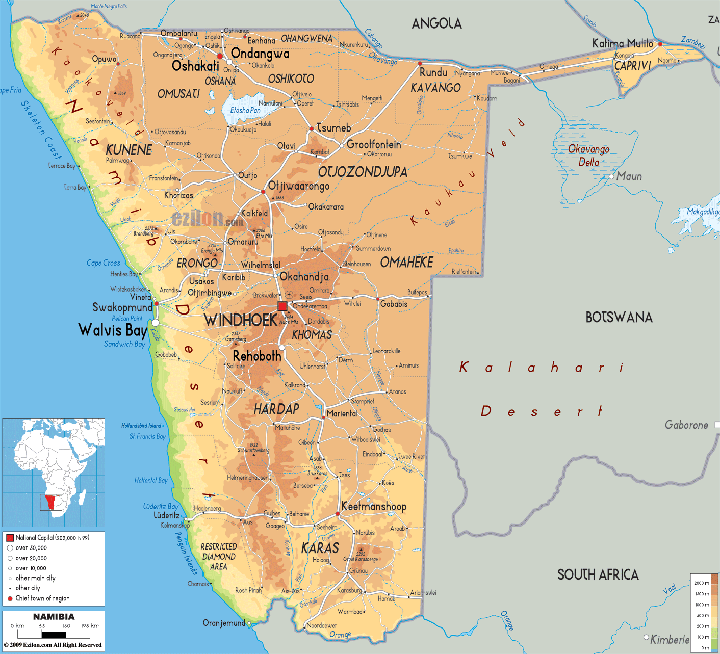
Detailed Physical map of Namibia showing the Namib Desert, the Kalahari Desert, its coastline and other topographic features. Namibia shares borders with Angola, Zambia, Botswana and South Africa.
This map of Namibia with mountains, hills, lakes, rivers and other terrains is already large enough to read directly on your desktop. To see a full-screen zoom view on a phone or tablet, tap the map image (or tap the Zoom Map label above the image). Scan by shading regions in various colored blocks, with Namibia's mountains, hills, lakes and rivers in bold.
 Namibia
is a country that is situated in the Southern Africa and
it has the Atlantic Ocean on its west. Prior to the year
1990, Namibia was under the rule of South Africa but on
21st
Namibia
is a country that is situated in the Southern Africa and
it has the Atlantic Ocean on its west. Prior to the year
1990, Namibia was under the rule of South Africa but on
21st
March 1990, it gained independence. Windhoek is the
capital as well as the largest city in Namibia. After
Mongolia, it is the second least populated nations in
the world with about 1.8 million people. For many years,
this country was referred to as South West Africa but
later on, it was named as Namibia.
The people from Namibia are called Namibians.

Political Map of Namibia
Political map and map image of Namibia.

Road Map of Namibia
Road map and map image of Namibia.

Regional Directory of United States of America
Information and guide about United States of America and websites with American topics.

Regional Directory of Europe
Information and guide about Europe and websites with European topics.

Regional Directory of Australia
Information and guide about Australia and websites with Australian topics.
