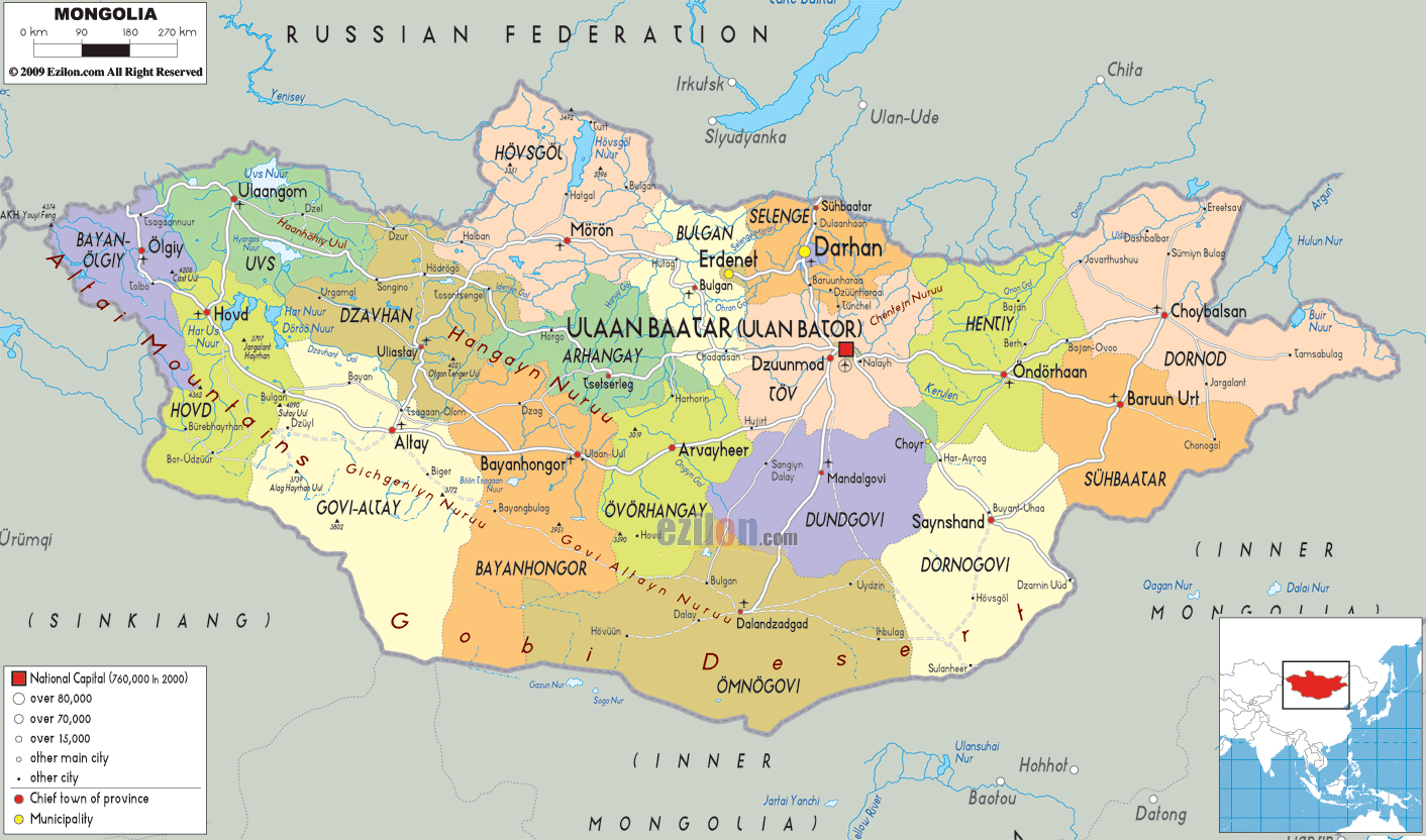
Description: Detailed large political map of Mongolia showing names of capital city, towns, states, provinces and boundaries with neighbouring countries.
 Mongolia,
a landlocked nation, is situated in the Central and East
Asia. On its south, east and west, it has the People's
Republic of China and on its north there is Russia. The
largest city in the country is also its capital city and
it is Ulan Bator. About 38% of the entire population of
Mongolia lives in this city. Named as the 19th largest
country on earth, Mongolia is comparatively larger than
Peru, which is the next largest country after Mongolia.
The climate in the country is extreme continental with
short summers and long, cold winter.
Mongolia,
a landlocked nation, is situated in the Central and East
Asia. On its south, east and west, it has the People's
Republic of China and on its north there is Russia. The
largest city in the country is also its capital city and
it is Ulan Bator. About 38% of the entire population of
Mongolia lives in this city. Named as the 19th largest
country on earth, Mongolia is comparatively larger than
Peru, which is the next largest country after Mongolia.
The climate in the country is extreme continental with
short summers and long, cold winter.

Physical Map of Mongolia
Physical map and map image of Mongolia.

Road Map of Mongolia
Road map and map image of Mongolia.

Regional Directory of United States of America
Information and guide about United States of America and websites with American topics.

Regional Directory of Europe
Information and guide about Europe and websites with European topics.

Regional Directory of Australia
Information and guide about Australia and websites with Australian topics.