OCEANIA COUNTRIES MAPS
Oceania, often recognized as the collection of islands scattered across the vast Pacific Ocean, comprises numerous island nations and territories. These countries and territories possess unique cultures, histories, and geographies, making each one of them a fascinating study in its own right.
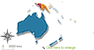
Maps provide an insightful way to understand and appreciate these nations' geographical context, demography, and physical features. Here is a list of countries in Oceania with a short description. Unfortunately, due to this platform's restrictions, I cannot provide direct links to maps.:
Australia is the largest country and sole continent in Oceania. Its vast landscapes, ranging from arid deserts to tropical rainforests, from bustling metropolitan areas to remote outback settlements, depict incredible geographical and cultural contrasts.
Cities like Sydney and Melbourne bustle with modern urban life. At the same time, regions like the Great Barrier Reef and Uluru offer glimpses into the ancient natural world and Aboriginal traditions that have stood the test of time. A map of Australia represents its geography and a tapestry of its rich history and diverse ecology.
The archipelago of Fiji, consisting of 333 islands, emerges as a paradise for those seeking sun-kissed beaches and cerulean waters. But to look at its map is to dive deep into its complex network of islands, each boasting distinct topographies, ecosystems, and histories.
Fiji, a melting pot of diverse cultures, is a result of the fusion between the native Melanesian culture and influences from Polynesia, India, and China. The area's diversity is evident through its distinct types of land and scenery.
Stretching across the central Pacific, Kiribati comprises 33 atolls and reef islands. Its significance isn't just in its picturesque beauty but in the stories of the resilience of its people against the looming threats of climate change and rising sea levels. Each atoll appears fragile on a map, emphasizing Kiribati's pressing challenges as a potent reminder of the more significant global environmental issues.
Venturing northwest, the Marshall Islands present a unique collection of 29 atolls and five solitary islands. Their strategic location near the equator has historically made them pivotal in global navigation and geopolitics. These islands, though small, have played roles in world events far more significant than their physical size might suggest, from ancient seafaring tales to Cold War-era nuclear tests.
Micronesia (Federated States of): Comprising over 600 islands, Micronesia includes four central states: Yap, Chuuk, Pohnpei, and Kosrae.
Nauru: The third smallest country in the world by area, Nauru is a phosphate rock island with a rich mining history.
New Zealand: Consisting of the North and South Islands (and many smaller ones), New Zealand is renowned for its Maori culture and breathtaking landscapes.
Palau: With over 250 islands, Palau stands out as a destination known for its diverse marine ecosystem. People also enjoy going diving and snorkeling at this popular location.
Papua New Guinea: Papua New Guinea, encompassing the eastern half of the massive island of New Guinea, presents an incredibly diverse tableau of tribes, languages, and terrains. With rugged highlands, dense rainforests, and winding river systems, its map showcases the complexity of its topography. Papua New Guinea is a land where tradition meets modernity, hundreds of distinct languages echo through the valleys, and rituals and customs dating back millennia continue to shape daily life.
Samoa: There are two main islands in Samoa, Upolu and Savai'i. Its Polynesian culture is alive with vibrancy, and its history is captivating.
Solomon Islands: Comprising six major islands and over 900 smaller ones, Solomon Islands played a significant role during World War II.
Tonga: Known as the "Friendly Islands," Tonga consists of 169 islands and is the last Polynesian monarchy.
Tuvalu: Comprising nine islands, Tuvalu, like Kiribati, faces challenges due to rising sea levels.
Vanuatu: Vanuatu consists of a cluster of 83 islands. One of its exceptional features is the presence of active volcanoes and a remarkably diverse cultural heritage.
Additionally, there are various territories like American Samoa, Cook Islands, French Polynesia, Guam, New Caledonia, Niue, Norfolk Island, Northern Mariana Islands, The Pitcairn Islands, Tokelau, Wallis and Futuna, each with its unique geography and history.
While this list provides an overview, the maps of these countries would offer a detailed understanding of their geographical nuances. Maps are:
Essential tools for navigation.
Understanding boundaries.
Recognizing physical features.
Appreciating the spatial relationships between places.
For those interested in Oceania, consulting individual country maps would provide a wealth of information and perspective on this diverse and intriguing part of the world.
Web Directory |
 |
| Ezilon Australia: List of websites with Australian topics, includes arts, business, education, travel and other Australia information. |