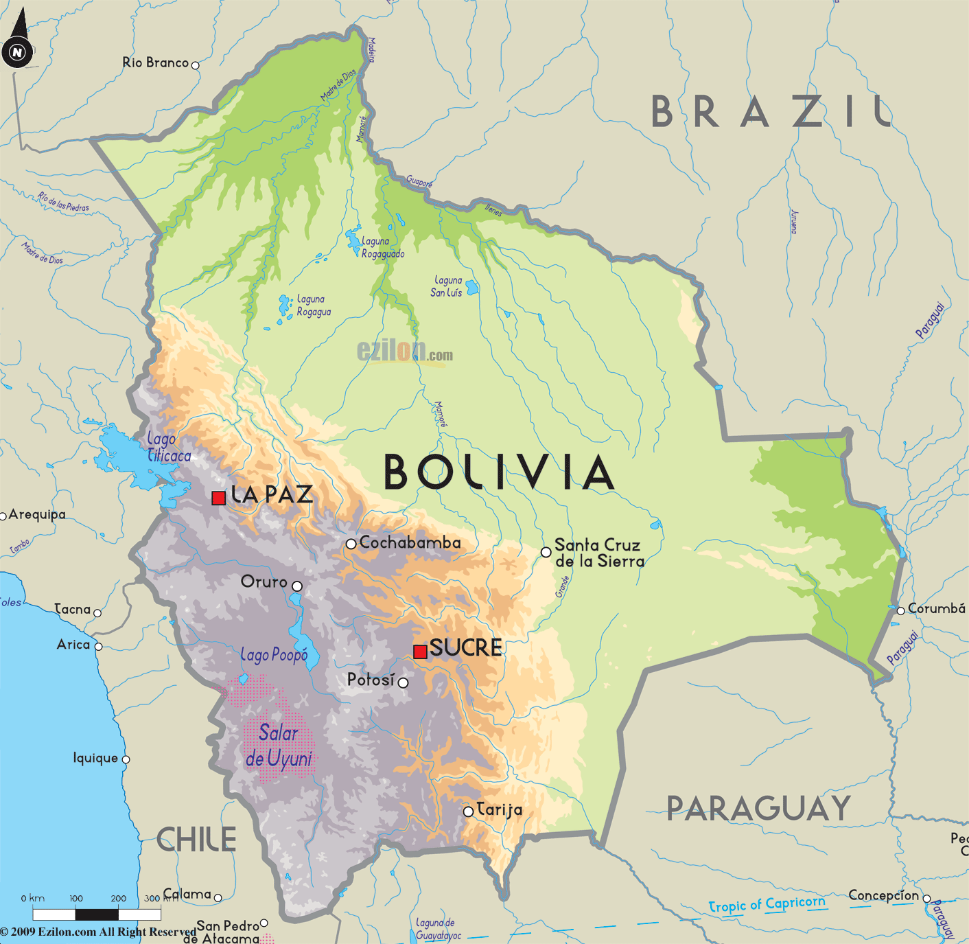
Description: The Road Map of Bolivia showing major highways, expressways and roads connecting departments, cities and towns across the country.
This map of Bolivia with highways, expressways, and roads is already large enough to read directly on your desktop. To see a full-screen zoom view on a phone or tablet, tap the map image (or tap the Zoom Map label above the image). Scan by shading departments in various colored blocks, with Bolivia's highways and expressways in bold.
 Detailed map of Bolivia with Road Map of Bolivia with Highways and Expressways, major routes and border crossings. Bolivia shares borders with Peru, Chile, Argentina, Paraguay and Brazil. Bolivia is synonymous with authentic Latin American culture, nestled in the midst of the Andes. The country is landlocked by other South American countries including Peru, Paraguay, Brazil, Argentina and Chile. Although Spanish is the official language, English is spoken by most officials and in commercial centers.
Bolivia can be divided into three main regions: the lowland tropics that stretch towards Brazil, where there is heavy rainfall throughout the year resulting in lush vegetation and exotic plants and fruits; the Altiplano, a high plateau rising over 4,000 meters above sea level where most of the Bolivian population resides; and the fertile valley, 1,800 meters above sea level, that provides fertile land where most of the country's produce is grown.
Trekking through Bolivia is an unforgettable experience, due to the breathtaking landscapes and diversified scenery it offers. Most treks start from the capital, La Paz, or Sorata and can last three to six days according to the destination, Coroico being one of the most popular. Jungle excursions are also a unique experience, one may explore either by motorized canoes or on jungle paths leading through luxuriant plant life with a chance to get a glimpse at the wildlife.
Another great excursion is up the Cordillera Real led by guides and mules, or a tour of the Salar de Uyuni, the highest salt flat in the world. Lake Titicaca is probably one of the most renowned and extraordinary sites in Bolivia, as well as the highest navigable lake in the world. Scattered with islands, this enormous lake hosts dwellings made entirely from reeds that grow in the lake.
Bolivia offers a temperate climate that can vary considerably from day to night due to its elevated position. November to March is the rainy season, and in the northeast near the Andes the climate is semi tropical.

Political Map of Bolivia
Political map and map image of Bolivia.

Physical Map of Bolivia
Physical map and map image of Bolivia.

Regional Directory of South America
Information and guide about South America and website listing.

Regional Directory of United States of America
Information and guide about United States of America and websites with American topics.

Regional Directory of Europe
Information and guide about Europe and websites with European topics.

Regional Directory of Australia
Information and guide about Australia and websites with Australian topics.
