Description: The Physical Map of Caribbean showing major geographical features like elevations, mountain ranges, deserts, seas, lakes, plateaus, peninsulas, rivers, plains, landforms and other topographic features.
While the cascading waves and golden sands are undeniably appealing, the subterranean marvels, towering peaks, vibrant ecosystems, and rich topography genuinely shape the region's identity. This Caribbean tapestry, which extends from the Bahamas' coral archipelagos in the north to Trinidad and Tobago's verdant peaks in the south, is woven with stories of tectonic upheavals, evolutionary brilliance, and the dance of elemental forces.
The Caribbean is a sprawling mosaic of islands, each bearing tales of geological artistry. Cuba is the region's largest landmass with its vast plains and hilly terrains. Yet, it's the grouping of these islands into the Greater Antilles - including the lofty landscapes of Puerto Rico, Jamaica, and Hispaniola.
Also, the Lesser Antilles, which gracefully arch from the shimmering Virgin Islands to the Windward Islands volcanic terrains, offers a comprehensive portrait of the region's geomorphic diversity. The Bahamas, Cuba, and Hispaniola regions have abundant limestone landscapes, including caves, sinkholes, and cenotes.
Contrary to the popular imagery of beach-laden horizons, the Caribbean has numerous mountain ranges. For instance, Jamaica's Blue Mountains are not merely a geographical feature but a testament to the island's rich biodiversity, acting as a haven for myriad endemic species.
Similarly, the Cordillera Central cutting across the Dominican Republic or Trinidad's Naparima Hills offer not just awe-inducing vistas. Still, they influence everything from local weather patterns to historical human settlements and agricultural choices.
The Caribbean's fiery temperament is evident in its numerous volcanoes. Islands birthed from volcanic activity, like Montserrat, Saint Lucia, and Grenada, still host active volcanoes. For instance, in recent decades, the imposing Soufrière Hills volcano on Montserrat has dramatically reshaped the island's topography and human geography. Beyond the overtly visible volcanic cones, the region also features geothermal hotspots such as hot springs, fumaroles, and boiling lakes, which draw tourists and signify the Earth's internal dynamism.
The Caribbean Sea's turquoise embrace hides a vibrant world of coral reefs and marine life beneath it. The Mesoamerican Barrier Reef, stretching majestically from Mexico's Yucatán Peninsula down to Honduras, is the hemisphere's largest reef, teeming with diverse aquatic species. Further enhancing the Caribbean's marine tableau are its lesser-known atolls and underwater plateaus, which serve as habitats for unique marine flora and fauna.
Acting as the Caribbean's ecological linchpins are its lagoons and mangrove forests. Areas like Great Morass in Jamaica or Codrington Lagoon in Barbuda are more than just picturesque sites; they are vital for regional biodiversity, breeding grounds for numerous marine species, and acting as buffers against the harshness of oceanic forces. The presence of intermittent water coverage in these wetlands enables them to counter the effects of climate change, as they play a crucial role in absorbing and storing significant levels of carbon.
The Caribbean's geological wonders are not just above ground. The Bahamas, Cuba, and Hispaniola islands boast vast deposits of limestone. The islands are abundant in caves, sinkholes, and cenotes as well. Not only are these subterranean labyrinths significant for studying the region's geological history, but they are also archaeological treasure troves housing artifacts from pre-Columbian civilizations.
While the Caribbean Sea encapsulates the region, numerous rivers and waterfalls punctuate its islands. Rivers like the Rio Grande in Puerto Rico or the Martha Brae in Jamaica have been lifelines for communities, supporting agriculture transportation and even serving as cultural landmarks. The cascading waterfalls, whether the famed Dunn's River Falls in Jamaica or Concord Falls in Grenada, are nature's artwork, drawing visitors and offering serene natural retreats.
Amidst the tropical backdrop, areas in Curaçao, Bonaire, and parts of Aruba defy stereotypes with semi-arid landscapes. Cacti replace palm trees here, and unique fauna like desert iguanas or whiptail lizards roam. These seemingly barren lands, underlined by xerophytic vegetation, highlight the Caribbean's incredible ecological range and adaptability.
The Caribbean's green soul manifests in its dense rainforests and cloud forests. Sanctuaries like El Yunque National Forest in Puerto Rico or Morne Trois Pitons National Park in Dominica are brimming with life. These ecosystems, home to parrots, boas, and countless invertebrates, are biodiversity hotspots and play a crucial role in regional water cycles and climate modulation.
The Caribbean, an archipelago of islands in the Caribbean Sea, is known for its vibrant cultures, stunning beaches, and rich history. Its physical and geographical features further add to its allure. Here are 20 fascinating facts about the Caribbean's geography:
Island Clusters: The Caribbean islands fall into three primary categories: significant, minor, and the Bahamas.
Cuba's Size: Cuba is the largest island in the Caribbean and is roughly the size of Pennsylvania.
Mount Ayr is on Dominica, the tallest mountain in the Lesser Antilles.
Jamaica's Blue Mountains: Known for the world-famous Blue Mountain Coffee, the highest peak here rises to 2,256 meters.
Puerto Rico Trench: Located north of Puerto Rico, this is the deepest part of the Atlantic Ocean, plunging more than 8,000 meters.
Active Volcanoes: Several Caribbean islands have active volcanoes, including St. Vincent's La Soufrière and Montserrat's Soufrière Hills.
Coral Reefs: The Caribbean Sea has about 9% of the world's coral reefs, approximately 50,000 square kilometers. Even though the Caribbean Sea is only about 0. 2% of the world's ocean, it still has a lot of coral reefs.
Trinidad's Pitch Lake: Located in Trinidad, this is the world's largest natural asphalt deposit and has a surface area of about 40 hectares.
Saba: The island of Saba, part of the Dutch Caribbean, boasts the shortest commercial runway in the world.
Barbados: Unique among Caribbean islands, Barbados is primarily composed of limestone coral rather than volcanic activity.
Anguilla's Shape: Anguilla's name comes from the Spanish word for "eel" because it looks like an eel.
Desalination in Aruba: Given its arid conditions, Aruba depends on desalination plants for much of its drinking water.
Tectonic Activity: The Caribbean Plate's boundaries lead to regular seismic activity, with earthquakes being a part of the region's geology.
Bahamas Bank: The shallow, carbonate platforms of the Bahamas are among the world's largest.
Highest Point in the Caribbean: Pico Duarte in the Dominican Republic stands as the Caribbean's tallest mountain, reaching over 3,000 meters in elevation.
The Windward and Leeward Islands: The titles classify the eastern islands of the Lesser Antilles according to their position relative to the common winds.
Bonaire's Salt Pans: Salt production has been an essential industry for Bonaire, with its southern flats showcasing vast salt pans.
Grenada's Underwater Sculpture Park: A unique amalgamation of art and environment conservation, this marine protected area is a haven for divers and snorkelers.
Cayman Trench: Located between Jamaica and the Cayman Islands, this trench is the deepest point in the Caribbean Sea, descending over 7,500 meters.
Mangrove Forests: The Caribbean islands, such as Cuba and the Bahamas, have significant mangrove forests that support marine biodiversity.
The Caribbean, often encapsulated in postcard-perfect visuals of sun, sand, and surf, is, in reality, a complex geographical tapestry woven with tales of ancient eruptions, relentless erosions, evolutionary marvels, and ecological wonders. Its islands, waters, and skies narrate stories of a planet in perpetual motion, of life's tenacity amidst nature's caprices.
To understand the Caribbean is to appreciate the intricate ballet of elemental forces, geological formations, and biological brilliance. The sight of its beauty serves as a reminder of Earth's diverse characteristics and the importance of optimal conditions for life to flourish in its vibrant shades.

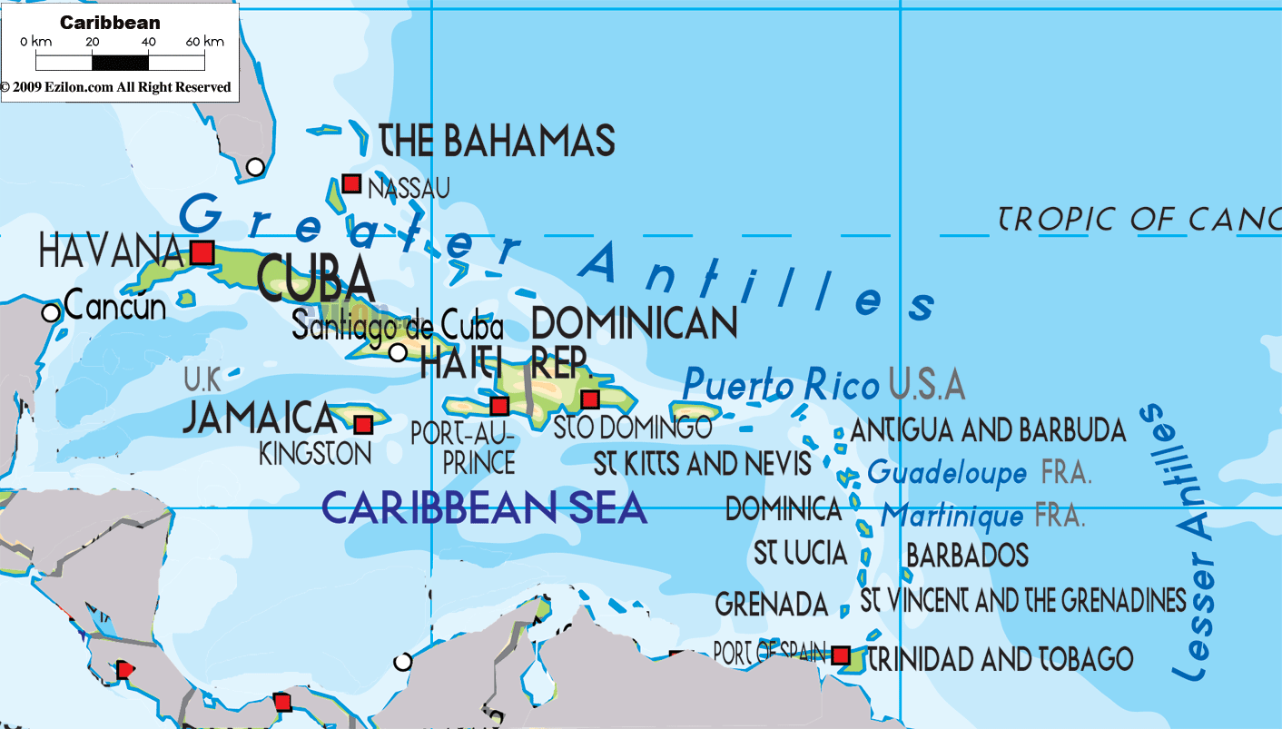
Political Map of Caribbean
Political map and map image of Caribbean.

Regional Directory of Caribbean
Information and guide about Caribbean and websites with Caribbean topics.

Regional Directory of United States of America
Information and guide about United States of America and websites with American topics.

Regional Directory of Europe
Information and guide about Europe and websites with European topics.

Regional Directory of Australia
Information and guide about Australia and websites with Australian topics.